The Complete Guide to the National Weather Service: How It Works & Keeps You Safe
How America’s Official Weather Agency Keeps You Safe

Every day, millions of Americans check their phones, turn on the television, or tune into the radio to find out if they need an umbrella or if they need to seek shelter. Behind almost all of this data is the National Weather Service (NWS).
As the official weather forecasting agency of the United States federal government, the National Weather Service provides weather, water, and climate data, alongside life-saving forecasts and warnings. Whether you use a commercial weather app on your smartphone or watch a local meteorologist on the evening news, the core data they rely on usually originates from the NWS.
But how exactly does this massive organization track a developing tornado, predict a blizzard days in advance, or know when a hurricane will make landfall?
In this comprehensive guide, we will explore how the agency operates, the technology it uses to predict the future, and how you can use its public resources to keep your family safe.
What is the National Weather Service?
The National Weather Service is a component of the National Oceanic and Atmospheric Administration (NOAA), which operates under the U.S. Department of Commerce.
The primary mission of the NWS is simple but profound: to provide weather, water, and climate data, forecasts, and warnings for the protection of life and property and the enhancement of the national economy.
Because weather impacts agriculture, aviation, maritime shipping, and daily commerce, the agency plays a crucial role in keeping the American economy moving. But its most visible and important role happens during severe weather events. When tornadoes, hurricanes, flash floods, or winter storms threaten communities, the NWS is the sole official voice for issuing weather warnings in the United States.
The NOAA and NWS Relationship
People often confuse NOAA and the NWS. The easiest way to understand the relationship is that NOAA is the parent organization. While NOAA handles a broad range of scientific duties—including ocean exploration, fisheries management, and climate research—the NWS is strictly focused on weather forecasting and public safety alerts.
Inside the NWS: Specialized Centers and Local Offices
The National Weather Service is not just one building in Washington, D.C. It is a vast, decentralized network of experts working 24 hours a day, 365 days a year across the country.
The agency operates through a combination of national guidance centers and local forecast offices.
Weather Forecast Offices (WFOs)
There are 122 local Weather Forecast Offices spread across the United States, Puerto Rico, and Guam. These local offices are the heart of the agency.
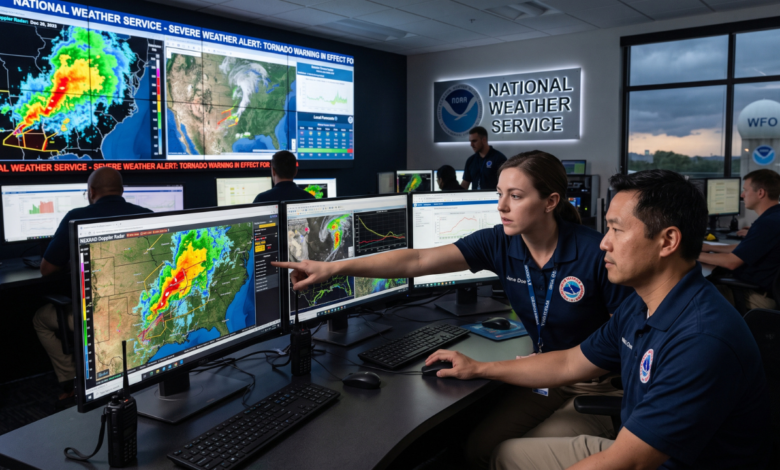
When a severe thunderstorm warning pops up on your phone, it wasn’t issued by a computer in Washington; it was issued by a meteorologist at your local WFO who is monitoring regional radar and data. Local meteorologists understand their region’s unique microclimates, terrain, and weather patterns, allowing them to issue highly accurate, localized alerts.
The Storm Prediction Center (SPC)
Located in Norman, Oklahoma, the Storm Prediction Center monitors the entire contiguous United States for the threat of severe thunderstorms, tornadoes, and dangerous fire weather. The SPC issues severe weather “Watches” (like a Tornado Watch), while the local WFOs issue the actual “Warnings.”
The National Hurricane Center (NHC)
Based in Miami, Florida, the National Hurricane Center tracks tropical cyclones across the Atlantic Ocean and the Eastern Pacific. During hurricane season (June 1 to November 30), the NHC works around the clock analyzing satellite data and reports from Hurricane Hunter aircraft to predict where storms will go and how strong they will be.
River Forecast Centers (RFCs)
The NWS also operates 13 River Forecast Centers. These centers monitor soil moisture, snowmelt, and rainfall to predict river levels. Their data is critical for issuing flood warnings and managing national water resources.
How the NWS Collects Weather Data
Predicting the weather requires an enormous amount of real-time data. To gather this information, the NWS relies on a sophisticated network of scientific instruments.
NEXRAD (Next-Generation Radar)
The NWS operates a network of over 150 high-resolution S-band Doppler weather radars known as NEXRAD. These massive radar domes emit pulses of energy into the atmosphere. When that energy hits rain, snow, or hail, it bounces back to the radar. This allows meteorologists to see exactly where precipitation is falling, how heavy it is, and which direction the wind is moving inside a storm.
GOES Satellites
NOAA operates the Geostationary Operational Environmental Satellites (GOES) system. Floating roughly 22,000 miles above Earth, these satellites provide continuous, high-definition imagery of cloud cover, lightning flashes, and atmospheric moisture. This is especially vital for tracking hurricanes out in the open ocean where radar cannot reach.
Weather Balloons (Radiosondes)
Twice a day, every day, at exactly the same time, staff at 92 locations across the US release weather balloons. These hydrogen or helium-filled balloons carry a small device called a radiosonde high into the stratosphere. As the balloon rises, the radiosonde beams back data on temperature, humidity, and wind speed at various altitudes. This vertical profile of the atmosphere is crucial for computer forecast models.
ASOS (Automated Surface Observing Systems)
If you look at the weather conditions for your local airport, you are likely looking at ASOS data. There are hundreds of these automated sensor suites across the country, constantly recording ground-level temperature, wind, visibility, and rainfall.
Supercomputers and AWIPS
All the data collected by radars, satellites, and balloons is fed into twin supercomputers operated by NOAA. These computers run complex mathematical models simulating the atmosphere. Meteorologists then view this data on a specialized software system called AWIPS (Advanced Weather Interactive Processing System), which allows them to slice, dice, and analyze the data to create their final forecasts.
Understanding Weather Watches, Warnings, and Advisories
One of the most important functions of the National Weather Service is communicating risk to the public. However, many people still confuse the terminology used during severe weather.
Here is exactly what these terms mean:
1. Weather Watch (Be Prepared)
A “Watch” means that the conditions are favorable for a dangerous weather event to occur. It does not mean the event is happening right now.
-
Example: A Tornado Watch means the atmosphere has the right ingredients to produce tornadoes. You should review your safety plan and stay tuned to local media or weather radios.
2. Weather Warning (Take Action)
A “Warning” is the highest level of alert. It means the severe weather event is occurring right now, is imminent, or has been spotted on radar.
-
Example: A Tornado Warning means a tornado has been sighted or radar shows a strong rotation. You need to take shelter immediately.
3. Weather Advisory (Be Aware)
An “Advisory” is issued for weather events that are largely an inconvenience or a hazard, but are not expected to be life-threatening if standard precautions are taken.
-
Example: A Winter Weather Advisory means periods of snow or freezing rain will cause travel difficulties, but it won’t reach the severity of a full blizzard.
A Brief History of America’s Weather Forecasters
The National Weather Service has a long and fascinating history dating back to the 19th century.
In 1870, President Ulysses S. Grant signed a joint congressional resolution creating a national weather warning service under the Secretary of War. This early organization was part of the Army Signal Corps.
In 1890, the organization transitioned to a civilian agency under the Department of Agriculture and was officially named the U.S. Weather Bureau. Its primary focus was helping farmers navigate the devastating impacts of weather on crops.
In 1940, the Weather Bureau was transferred to the Department of Commerce to better support the booming aviation industry. Finally, in 1970, the agency was rebranded as the National Weather Service and placed under the newly formed NOAA.
The 1990s saw a massive modernization of the NWS, a multi-billion dollar effort that introduced Doppler radar and advanced supercomputing to local offices, drastically reducing the fatality rates of tornadoes and flash floods.
How to Use the National Weather Service for Local Forecasts
While mobile apps are convenient, they are mostly automated. When you want a forecast written by a human meteorologist who understands your local area, you should use the official NWS website.
Here is how to get the most out of it:
-
Visit Weather.gov: Go to the official website (weather.gov).
-
Enter Your Zip Code: In the top left corner, enter your city or zip code.
-
Read the Point Forecast: You will be taken to a page tailored specifically for your neighborhood, complete with a detailed text forecast.
-
Check the Forecast Discussion: Scroll down and click “Forecast Discussion.” This is a highly detailed, scientific explanation written by the local meteorologist explaining why they are forecasting certain conditions. It provides incredible insight into the uncertainty or confidence they have in the upcoming weather.
Why Use Weather.gov?
Unlike commercial weather sites, weather.gov has no advertisements, no clickbait headlines, and no sensationalized warnings. It provides pure, scientifically backed data funded by your tax dollars.
How the NWS Sends Emergency Alerts
When seconds count, the National Weather Service relies on multiple pathways to get warnings to the public.
-
NOAA Weather Radio (NWR): This is a nationwide network of radio stations broadcasting continuous weather information directly from the nearest NWS office. Every home should have a battery-operated NOAA Weather Radio, which acts like a smoke detector for severe weather, waking you up if a tornado warning is issued at night.
-
Wireless Emergency Alerts (WEA): The NWS works with cellular providers to push critical warnings (like Tornado Warnings or Flash Flood Warnings) directly to mobile phones in the path of the storm.
-
EAS (Emergency Alert System): This system overrides local television and radio broadcasts with the familiar alert tones, displaying the warning text on the screen.
The Future of Forecasting
As technology evolves, the National Weather Service is constantly adapting.
The agency is currently integrating more Artificial Intelligence (AI) and Machine Learning into its operations. While AI will not replace human meteorologists anytime soon, it is helping computers process vast amounts of satellite data faster, identifying tiny cloud features that precede rapid tornado development.
Furthermore, as climate change leads to more frequent and extreme weather events—such as heavier rainfall rates and rapidly intensifying hurricanes—the NWS is focusing heavily on “Impact-Based Warning.” This means moving beyond just stating the facts of the weather, and explicitly communicating the specific impacts (e.g., “This storm will produce unsurvivable storm surge,” or “This tornado will cause catastrophic damage to homes”).
Summary
The National Weather Service is an indispensable part of American life. From the farmers deciding when to plant crops, to airline pilots navigating cross-country flights, to families taking shelter from a storm, the NWS operates silently in the background, keeping the country safe and informed.
By understanding how the agency works, paying attention to its watches and warnings, and utilizing local forecast resources, you can ensure that you and your loved ones are never caught off guard by Mother Nature.
-
FAQ
Is the National Weather Service a government agency?
Yes. The NWS is a federal government agency. It is a sub-agency of the National Oceanic and Atmospheric Administration (NOAA), which falls under the U.S. Department of Commerce.
What is the difference between NOAA and the NWS?
NOAA is the parent organization that handles broad environmental research, including oceans, fisheries, and climate science. The National Weather Service is a specific division within NOAA solely dedicated to weather forecasting, data collection, and public weather alerts.
Does the National Weather Service have a mobile app?
The NWS does not have an official, standalone mobile app for the public. However, you can access their mobile-friendly website by navigating to mobile.weather.gov on your smartphone’s browser, which functions very much like an app.
How accurate are NWS forecasts?
NWS forecasts are highly accurate, especially within a 3-to-5-day window. Their accuracy for predicting hurricane tracks and severe weather outbreaks has improved dramatically over the last two decades due to advancements in Doppler radar, satellite imagery, and supercomputing.
How do I find my local NWS office?
You can find your local office by visiting weather.gov and entering your zip code. At the top of your local forecast page, it will list the specific Weather Forecast Office (WFO) responsible for your region, along with links to their specific social media pages.